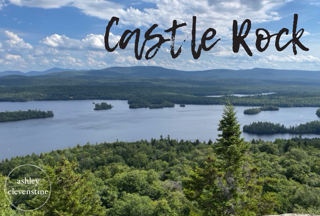
This weekend, we went canoe camping on Blue Mountain Lake. While researching the area before our trip, I was excited to discover that Castle Rock could be accessed directly from the lake. Since we were already camping by canoe, it was just a short paddle farther to reach the trailhead.
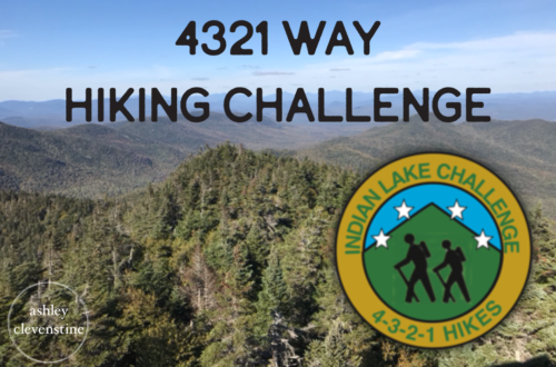
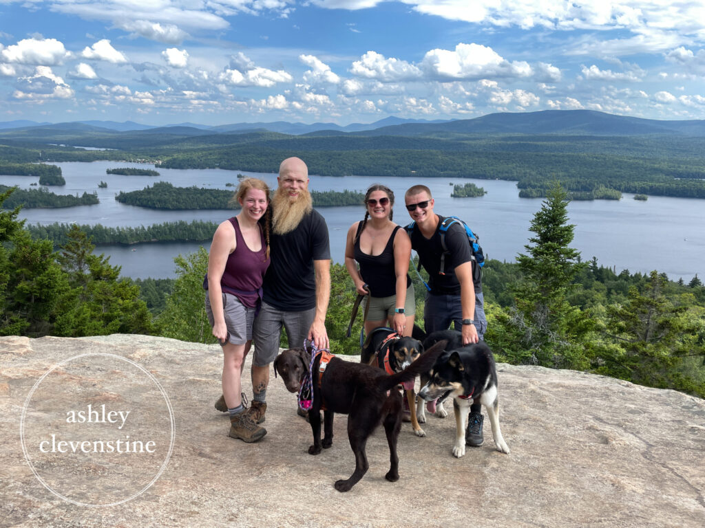
Even better, completing this hike would bring me one step closer to finishing the 4-3-2-1 Way Challenge. This hike was especially memorable because Darby was with us, along with some friends and their two pups.
Hike Report
July 23, 2022
It was an absolute scorcher of a day—hot, sunny, and featuring that classic Adirondack blue sky with only a few clouds overhead.
We set out in the canoe in search of the trailhead. Finding it took a little longer than expected. The guidebook directions were somewhat unclear, and the GPS wasn’t doing me any favors (although, if we’re being honest, that was mostly user error on my part). Somehow, Josh knew exactly where we needed to go. He patiently let me try to figure it out before eventually taking charge and leading us right to it.
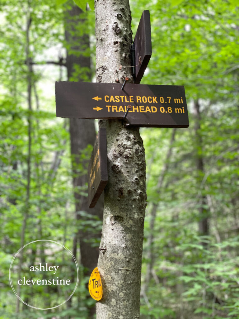
Once we found the landing, we tied up the boats and started hiking. The trail from the lake to the main Castle Rock Trail is about 0.2 miles, and from there it’s another 0.7 miles to the summit.
This hike absolutely did not disappoint.
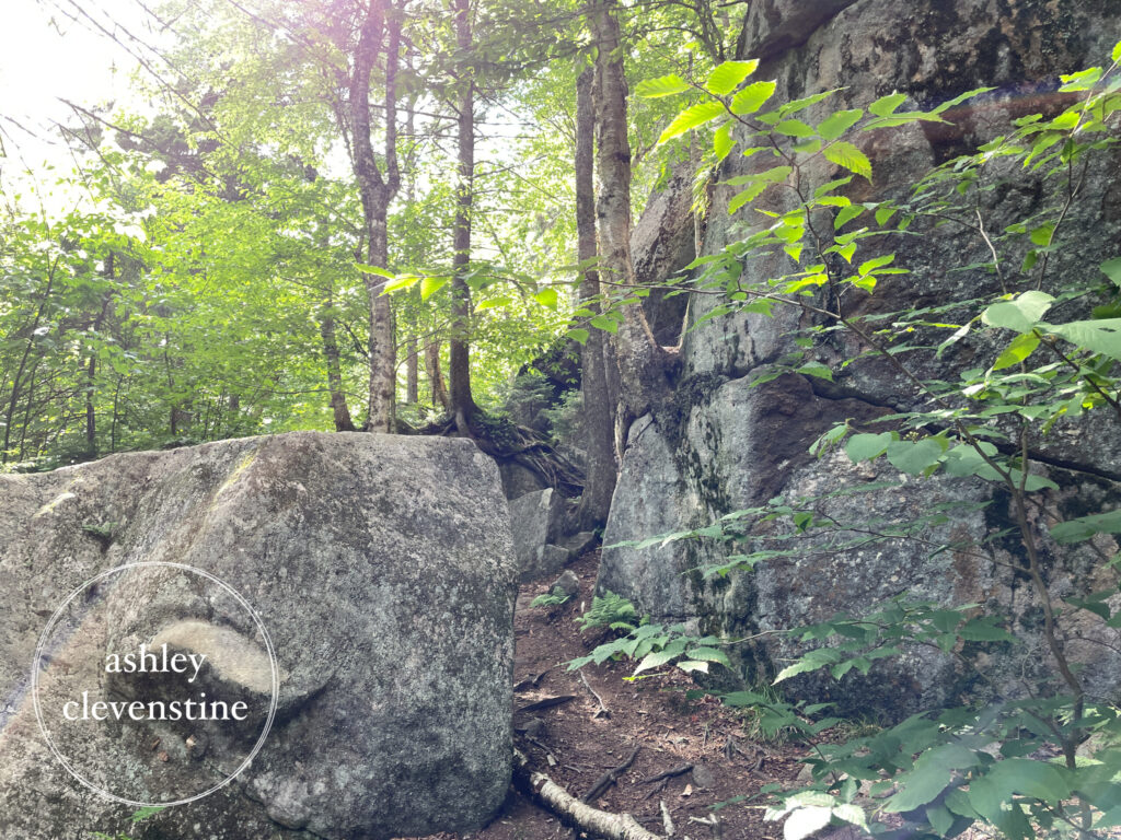
About halfway up, we discovered a side path that wound through a series of rocks and small caves. It appeared to cut off a section of the main trail, but it was worth exploring regardless. The rock formations added a fun and unique element to the hike and quickly became one of my favorite parts.
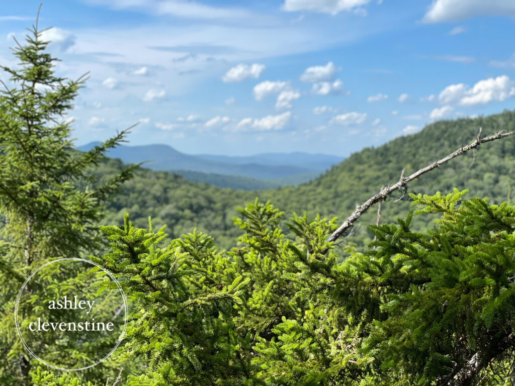
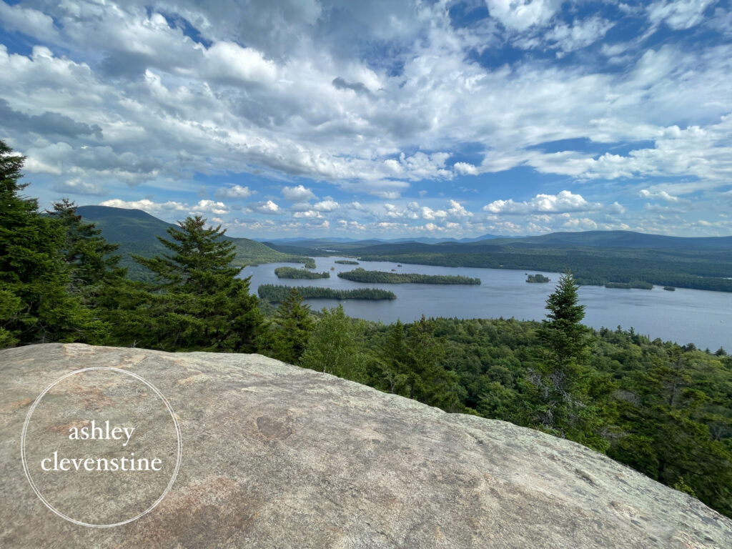
We reached the summit in less than an hour and spent some time enjoying the views, taking photos, and watching Keiser launch himself across a massive gap in the rocks—a move that nearly gave the rest of us heart attacks.
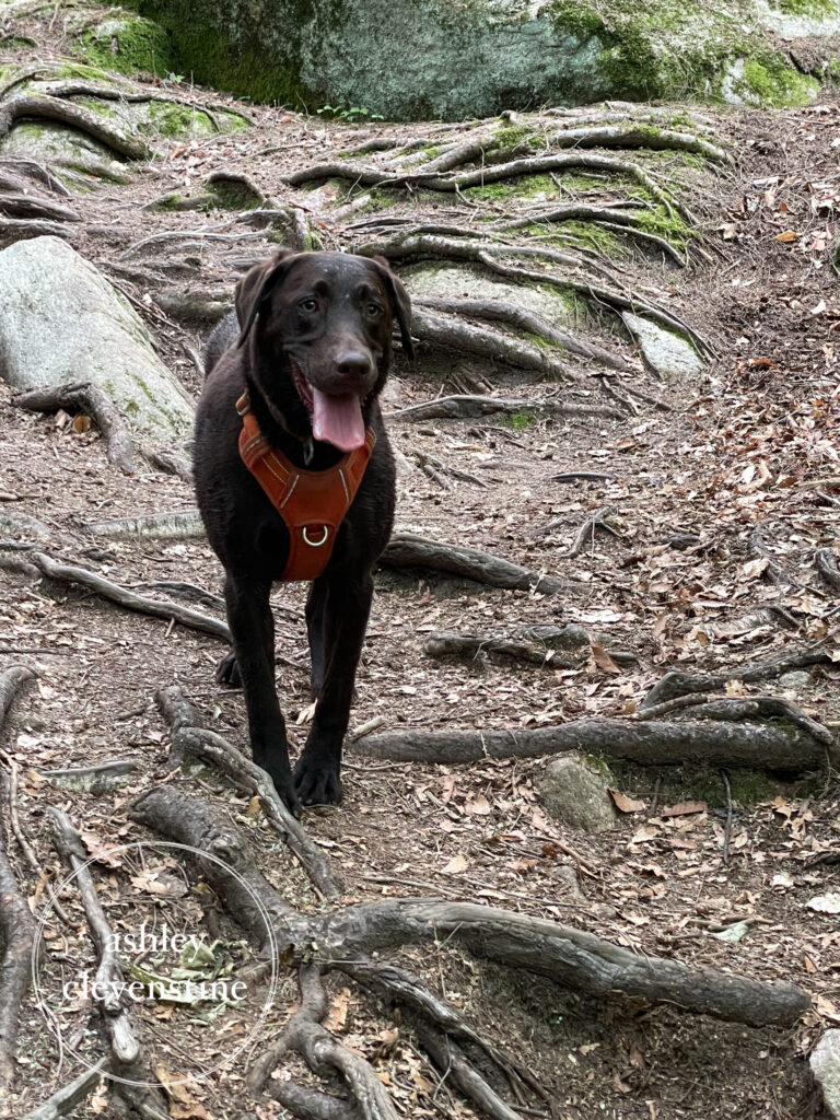
Darby did great on this hike. I’m really proud of how far she has come as a hiking companion. Hiking was never her favorite activity, and she definitely wasn’t a fan of being leashed, but she continued to improve with every adventure. Despite her occasional reluctance, she always seemed to enjoy being out there with us—probably because she knew how much I loved it.
After spending some time at the summit, we headed back down to the canoes and paddled to camp, where a refreshing swim and a well-earned dinner were waiting for us.
Trip Stats
- Distance: 2.1 miles (plus approximately 1 mile of paddling from our campsite)
- Total Time: 1.5 hours (hiking only)
- Elevation Gain/Loss: +792 ft. / -781 ft.
- Weather: Mostly sunny, hot, with a bright blue sky and few clouds
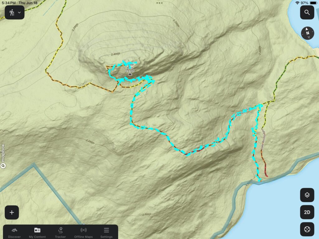
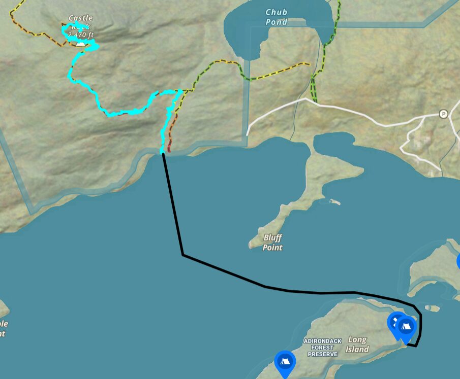
- GPS System: Gaia GPS (map images below from OnX Backcountry) – Image 1 is the hiking track, Image 2 shows the canoe paddle route from the campsite to the lake access trail head.
Rating
10/10
This was one of the coolest hikes I’ve ever done. Between the paddle to the trailhead, the unique rock formations and caves, and the stunning summit views, the entire experience felt like an adventure from start to finish. If you’re visiting Blue Mountain Lake, I highly recommend adding Castle Rock to your itinerary.
Happy Hiking!